Infra­structure asset management

Road condition data to support decision-making processes

Road and street network are valuable infrastructure which is worn down by intensive use of traffic and has a major impact on the safety of road users. Studies on road network’s condition provide important information by which municipalities, cities, the Finnish Transport Infrastructure Agency and ELY Centres can plan the improvement of the road network, maintain the condition of the pavements and decide on where to allocate funding.

We are the leading supplier of analysis, survey and quality control services relating to road and road environment investments in Finland. We are the pioneer of digitalisation in the infrastructure sector. We develop and use the latest technology, such as imaging technology, computer vision and artificial intelligence to provide our customers with reliable information about the current condition and future needs of the road and street network.

Our service offering includes, among others, road surface monitoring (quality and condition measurements), digital imaging of the road and street network (still and 360), surface defect inventories and analyses, ground-penetrating radar measurements and road marking condition measurements. We provide laser scanning (point cloud), road structure drainage analyses, load-bearing capacity measurements, equipment and device inventories in road environment (traffic signs, railings, culverts, etc.) and repair backlog analyses.

Measurements

Road surface monitoring (RSM) to ensure the safety and comfort of driving

The safety and driving comfort of roads is primarily affected by the ruts and unevenness of the surfacing material and pavement defects. In order to study these and find the spots where ruts are too deep or excessive unevenness, we offer RSM-measurements.

The unevenness of the road affects the vehicle’s vibration and the comfort of the passengers. Great unevenness of the surface wears the vehicle down faster, causes damage to the surrounding structures and damages the surfacing material.

Ruts, on the other hand, increase the risk of aquaplaning. In addition, any water standing still in the ruts damages the pavement and road structure over time. Drainage is also inefficient if the water flows along the ruts, creating ponds of water in wrong places.

By combining the road information with vehicle model information, we receive data of the interaction between the vehicle and the road and its key mechanisms, such as the driving experience and the controllability of the vehicle.

We measure the unevenness and ruts on about 100,000 kilometres of road in Finland and Sweden every year. The results allow for targeting maintenance operations on the sections that need them the most.

Neural network-based damage interpretations support surface defect reports

In addition to information about the condition of the surface, studying pavement defects offers information about the condition of the structure of the road or street. Damage surveys provide excellent information for the maintenance and planning of roads, scheduling and optimising the paving and analysing the road and street network level.

We offer an automatic surface damage measurement service that identifies any damages of road surfaces through image interpretation. We also offer a neural network-based damage interpretation service, which we have used in various projects in Finland and abroad with great success.

Savings through ground-penetrating radar measurements

Ground-penetrating radar measurements represent the most advanced technology in road condition surveying. It provides information about the thickness and condition of the structures of a road or street and the quality of subsoil several metres deep without breaking the surface of the road.

This technique provides significant cost and time savings as it allows for precise targeting of actions and any possible additional studies at the problematic areas and depths. The measurement is also ideal for the quality control and assurance of new structures.

Laser scanning provides a quick, comprehensive 3D model

We provide a laser scanning service by which we can create a quick 3D model of the reality with a “point cloud”. In the future, an increasing number of infrastructure and construction projects will have their baseline information obtained via laser scanning as the point cloud can be used in various types of design phases. 

Our largest project currently in progress is the laser scanning of the Swedish road network, in which we scan about 50,000 kilometres of road every year.

We can use the point cloud material to create terrain models for road projects, for instance. In such a model, we vector the different elements of the road environment, including the edges of asphalt, road markings, traffic signs and barriers as well as any other elements, such as bridges, ditches, power lines and buildings. This makes it possible to use even more accurate information as a basis for the design phase and using work machine automation in the construction phase.

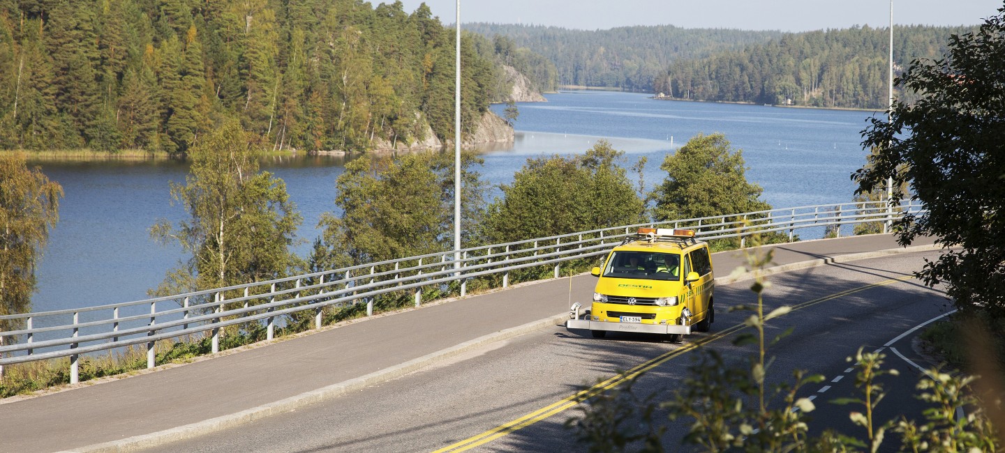
The road environment is scanned by driving a car at the speed of other traffic. In this way, minimal disturbance is caused.

Other infrastructure asset management services

Equipment and device inventory services to support asset management

Traffic signs, culverts, stormwater sewers, curbstones, light posts and other similar pieces of equipment and devices are a major part of road and street assets. Their impact on traffic safety and the daily service level experienced by road users is considerable.

We offer an inventory service for the equipment and devices on the road and street network, i.e. obtain information about their numbers and properties. This information is needed in repair and maintenance contracts as well as for asset management, cost monitoring, replacement and new investments, traffic services, planning and various studies.

We also offer a condition information inventory service. This information is needed in establishing repair and maintenance action lines, defining and monitoring functionality criteria and surveying the condition of the whole asset mass.

Repair backlog service to support decision-making processes

We help municipalities and cities make the maintenance of the street network more efficient by providing financing needs analyses, repair backlog calculations, paving programmes and condition reports to support decision-making processes. We also offer a map-based information service that provides information about the extent and progress of the measurements as well as the condition of streets.

In its simplest and most affordable form, our service is based on taking photos of the street network every 10 metres. The service can be expanded with a laser scanning service that provides more information about the ruts and inclination of the street and other information related to the street’s 3D profile.

Even a more accurate overall picture of the street and its environment can be established with laser scanning. If you also need information about the structure below the surfacing, ground-penetrating radar measurement can also be added to the service.

We offer a comprehensive service package that includes project planning, measurements, analyses and long-term plan preparation. Alternatively, customers can select the services they need and do the rest themselves with Destia’s software.

Questions? Contact us!

Eeva Huuskonen-Snicker

Head of Unit

Infrastructure Asset Management

+358 40 657 7281

eeva.huuskonen-snicker@destia.fi

Arto Kuskelin

Director

Urban Design and New Services

+358 40 546 0126

arto.kuskelin@destia.fi